 +420 284 684 535
3D laser scanning, land and aerial photogrammetry
3D laser scan
- datas obtaining using 3D laser scan
- datas processing SW Real Woks and CAD
Examples of usage:
- 3D geodetic documentation of buildings, bridges, tunnels…
- 3D serveying of facades
- 3D topographic plans
- 3D survey for calculating cubic capacity
- 3D survey of technologies outside and inside buildings
Examples of outputs: 3D cloud of points, 3D animation of objects (flying through)
Note: 3D outputs can customer use with freeware softvare (view, measure distances)
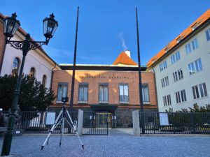
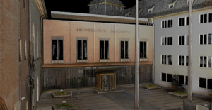
Charles University … point cloud
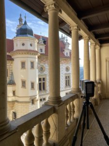
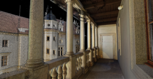
Palace Průhonice … point cloud
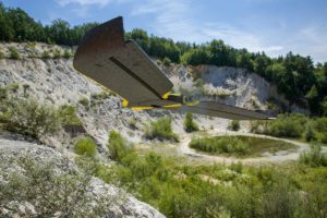
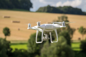
Aerial photogrammetry
- datas obtaining using UAV (we own pilot licence)
- datas processing SW Agisoft, Real Woks and CAD
Examples of usage:
- 3D serveying of facades and roofs
- 3D topographic plans of the terrain or relief
- 3D survey for calculating cubic capacity
- photos and videos fo presentation
Examples of outputs: ortophotomap, 3D cloud of points, contour lines plan, DMT / DMR
Land photogrammetry
- datas processing SW Agisoft, Real Woks and CAD
Examples of usage:
- 3D serveying of facades
- 3D survey for calculating cubic capacity
Examples of outputs: ortophotoplan of facades, 3D cloud of points, contour lines plan, DMT / DMR